

Eurovelo: Diesel and Dust
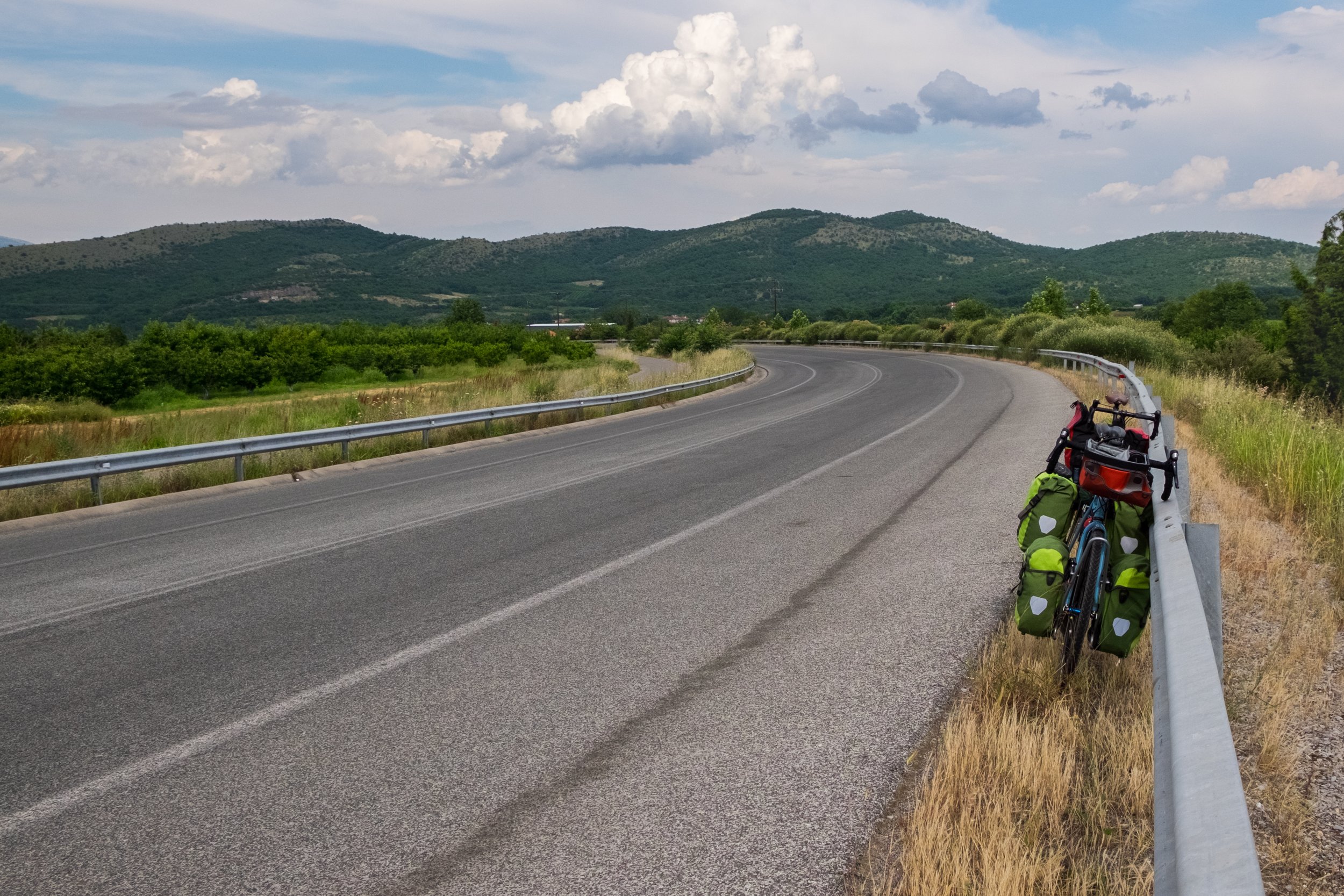
Despite starting the day with a cold shower I could already feel the sweat running down my back as I stepped out the hotel door. We both carefully loaded our bikes for the first real days riding, making sure each pannier was properly seated on our racks, and that everything was strapped down tightly. As we rolled down the road we were both understandably nervous, not about the journey — that was just a bike ride after all — but about battling with a major cities traffic on badly rutted roads while riding on the wrong-side of the road.
As soon as we pushed away we realised how right we were to be worried about the traffic. We’ve spent our entire lives riding on the left-side of the road, so our natural inclination was to ride to the left, not the right. Mix in the cars which were often parked two–or–three abreast and the experience wasn’t a tranquil one of cruising alongside a road in a segregated cycle lane; it was an experience of battle with vehicles as cars, lorries and vans moved all around us driving us back towards the very edge of the road where the ruts were at their worst. Eventually we passed a motorway junction, and the traffic died off; finally we had some room to breath.
Stopping for a break we got a chance to take in our surroundings. We were next to a scrap yard with dogs wondering around inside, where we hoped they’d remain, we could’t afford for any issues this early in the trip. Dust hung in the air from the last car to pass, slowly settling on the road we’d soon be riding along. This place felt alien — riding on the right-hand side of the road still felt unnatural, as Max regularly demonstrated as he’d pull out of a junction aiming for the wrong side of the road until I shouted after him.

After scoffing a few snacks we both wobbled our way back to the edge of the road — still getting used to the unusual feeling of a loaded bike — and cautiously joined the main carriageway, reminding ourselves over and over ‘ride on the right, ride on the right’. Slowly we got used to this feeling and started to enjoy ourselves as we cranked the bikes up to speed and then onwards towards the days destination.
Neither of us really knew how far we’d make it over these first few days. We knew it would be hard while our bodies conditioned themselves to the abuse of cycling for nine to ten hours a day with a 30kg load, and the heat was still making us suffer even out of the reflective and breathless enclosure of the city buildings.
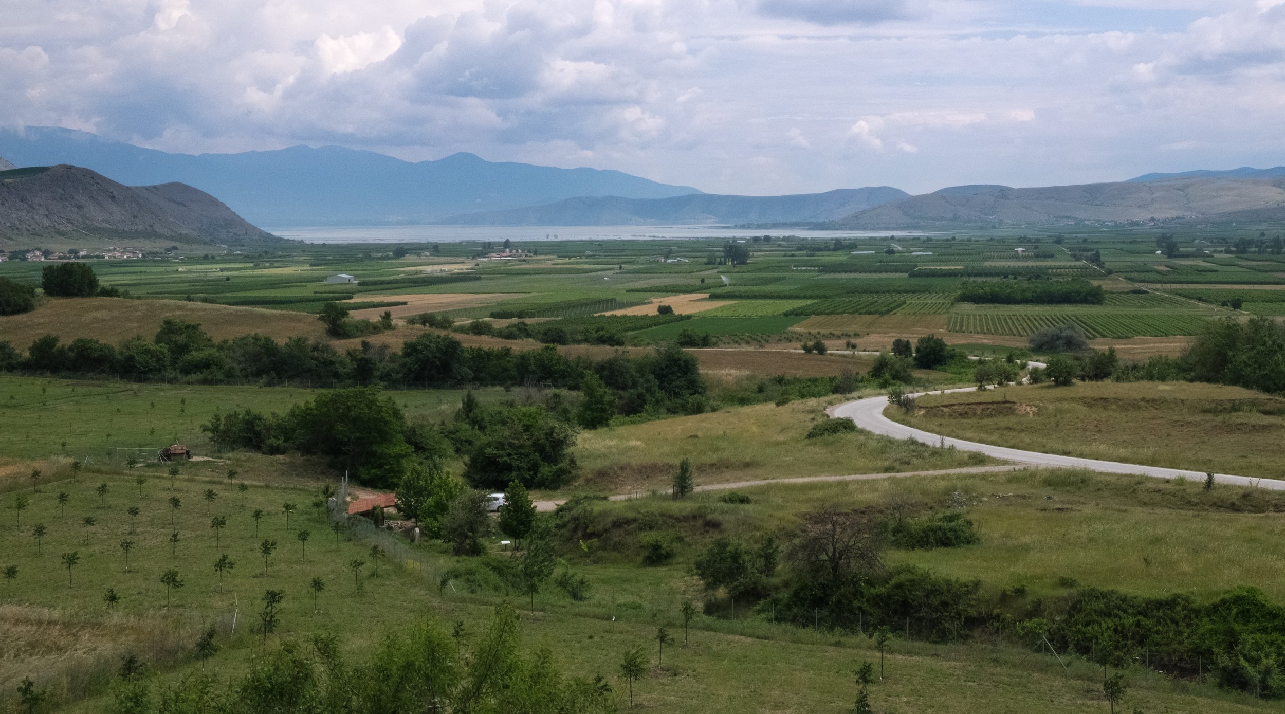
During the first few days I was looking forward to heading inland towards the higher ground where their would be more altitude to reduce the heat, and a breeze to help further reduce the temperature that was in the high twenties throughout our time in Greece.
Around midday during our first day we diverted off course into a nearby town to get our first meal away from any tourist hotspots. We passed up and down the bustling hughstreet several times before settling on a fast-food type place which was clearly popular and provided plenty of shelter outside. With a stream of grunting and pointing from both sides we managed to order two portions of Souvlaki, two cokes, and two large bottles of water to refill the bottles on our bikes with.
We were going through a lot of water while our bodies adapted to the heat. On my bike alone I was carrying two insulated 750ml bottles, and a 650ml bottle, and my trusty old 1l Sig bottle I’ve had for almost as long as I can remember. This totals just over 3kg in water at the start of the day, and all my bottles were now down to dregs. After lunch we pushed on with our aim of reaching Edessa by the end of the day.
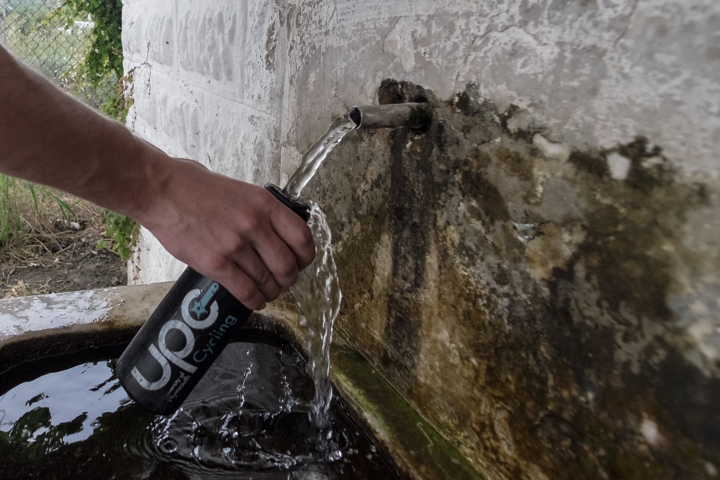
Towards mid-afternoon we were in for our first soaking of the trip. As we pulled over to the side of the road to make use of a public water fountain to refill our bottles again the rain started to fall around us. This wasn’t like a normal bit of British drizzle, out was proper rain with large drops that would bounce as they hit the ground. We made the call to sit out the worst of it in the shelter over the water fountain.
Once we got going again we were heading into our first real climbing. Given the time of the day we decided to avoid the busy town of Edessa and make use of the new bypass that took a gentler route up the hill. This dual-carriageway road was completely deserted aside from a single maintenance vehicle precariously balancing on two wheels near the top of the long climb.
As we approached Agras we didn’t have enough time to cover any more significant ground, but it was still a little early to pitch the tents above a lake we’d spotted on the map. We decided to stop for an ice cream before pushing on, and as we stood in the small village eating our ice creams we could both feel the eyes of everybody on us. We were the two outsiders in this village that was rarely a stopping point for anyone passing this way. As we stood there a person walked up to us as introduced himself as Tony, from Albania.
Tony explained to us both that he was here picking cherries for work, as he couldn’t find any at home. He told us how in Albania there’s only enough work for 1/4 of it’s population. We chatted to him about what we were doing, and then he tried to ask us about the football (neither Max nor I follow football at all, so this didn’t go so well). After a short while he told us to wait there for a moment, he had something for us. He ran off and came back a couple of minutes later with a pair of Nectarines, giving us one each.
At this point we had to move on before it got dark. We pushed on heading out of town on a new road until we couldn’t see any building around us anymore. We dived off down a small farmers access track and found a sheltered field out of sight from the road where we’d be able to pitch our tents. We were low on water yet again, so we consulted the map and found the nearest water was in the reservoir at the bottom of a significant hill. Without any real choice in the matter we decided to start descending to get the water we needed to cook and eat for the night.
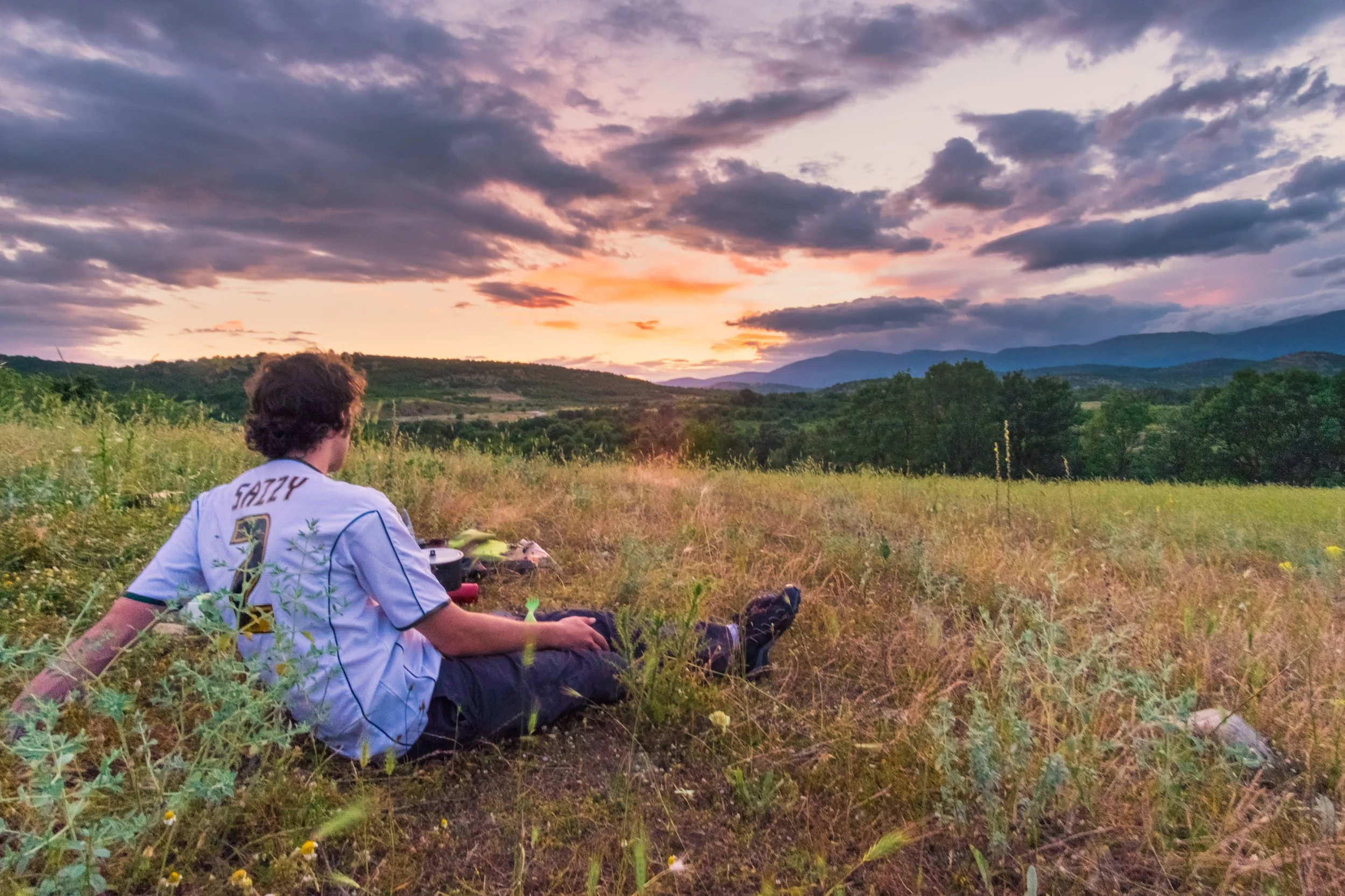
We returned to the main road and turned off onto a side road we could use to access the reservoir. Just as we did this a lorry stopped and asked us what we were doing. Max explained we were going to get water, and the driver simply handed us a large 2l bottle out of his cab before heading on, saving us a significant effort. We returned to our spot and proceeded to pitch our tents on the rock-hard ground and cook to a stunning sunset.
When you’re on a long trip like this is takes a few days to establish a routine. Routines are good, they make your daily chores more efficient and as a result you can get going quickly each day. Its safe to say that at this stage we didn’t have any routines at all, although I tried to keep things as close to my normal backpacking routines as possible. This meant as soon as I was awake I put some water on to boil while I started packing my gear away. By the time the water was done all of my sleeping stuff was packed in a pannier. At this point I would make the drinks while packing the rest of my gear down. By the time that is done the hot drinks are at a perfectly drinkable temperature, so I’ll sit and eat some food while drinking my tea or coffee and waiting for Max to finish packing his last few bits away.
On this first day this routine took about 90-minutes as neither of us were familiar with where things would sit in out panniers. When they’re piled up on the floor it can be difficult to visualise where each of them sits on the bike which makes it difficult to remember what each is for.
We headed back up to the main road — which was completely deserted at what was now 9am — stopping along the way to pick some cherries from a tree we passed. We didn’t have any real breakfast, only snacks, so we decided to aim for a first stop at a petrol station that was also marked as a Café on the maps with the hope of being able to find more water and something more substantial to eat.

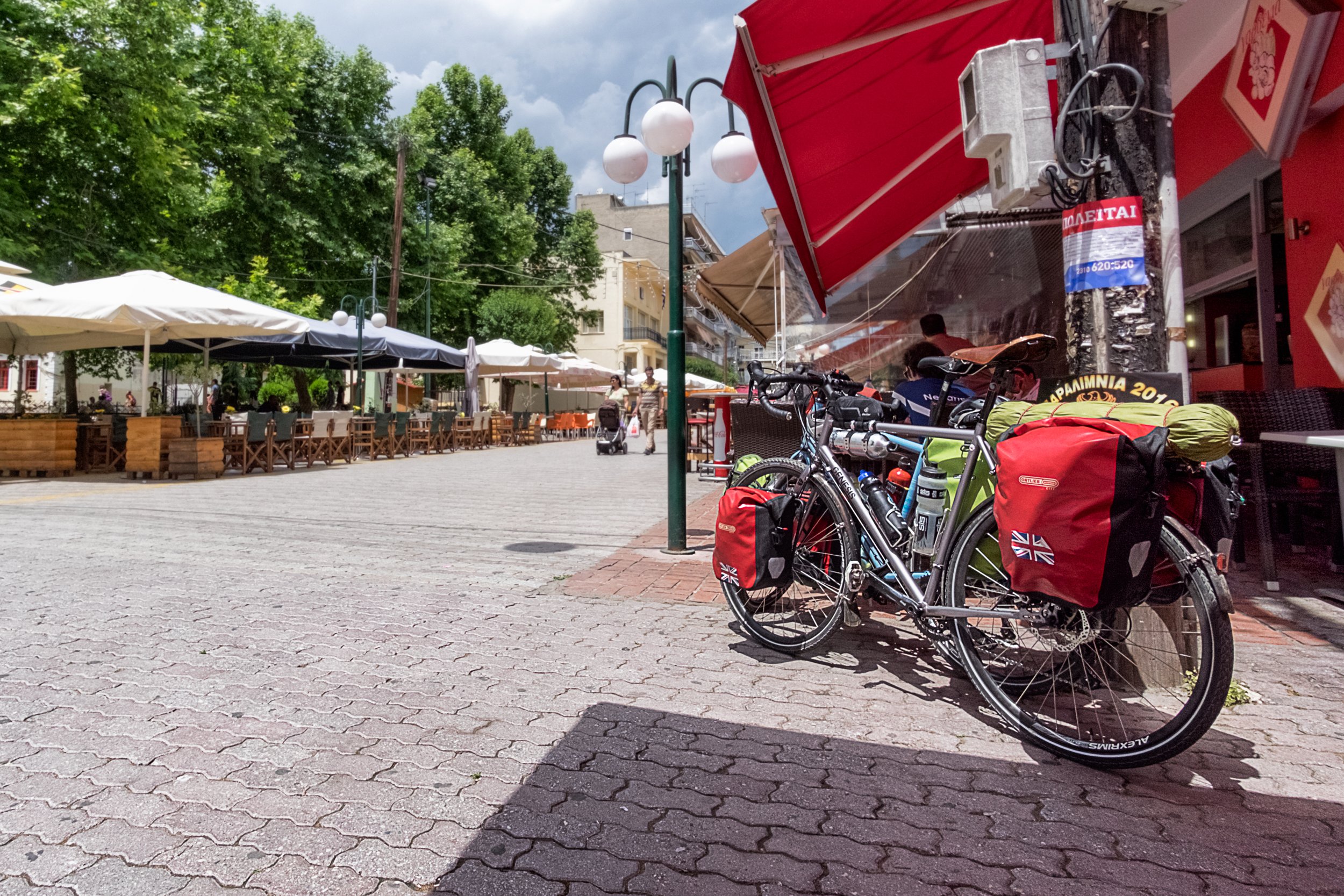
Over the next few hours we really just got our heads down and tried to put some decent miles in. We wanted to cross into Macedonia — something which would give us a feeling of starting to make progress on the sixteen–country tour. We put a decent number of miles away thanks to the reasonable roads now that we were in less trafficked areas and found ourselves near the village of Néro around lunch. Max didn’t want to ride past the village and double back a few short kilometres to access the village so we took our panniers off the bikes to carry them over the road-side barrier and down a steep slope, reattaching the panniers at the bottom.

Néro was not what we expected it to be. We rode around aimlessly looking for the village centre where we hoped to find a shop to buy some lunch. When we found the village centre we waited for a man to finish washing under the water fountain before filling our bottles. We quickly discovered the water tasted disgusting, much like that from the Roman Baths spring in Bath, UK. We abandoned this and leant our bikes up on the Café windows before heading in for lunch.
Inside Max said giasou (Greek for ‘Hello’) to which a man replied by shouting ‘English!’ loudly and repeatedly while pointing at a younger woman. We were both amazed to find ourselves sat in a tiny café in rural Greece only to find another person speaking English; we were well off the beaten track at this point, with nothing particularly touristy for over 100km.
The lady sat us down at the table while we tried to ask for food. Our conversations were awkward and slow, with lots of gesturing and both of us finding and pointing to various phrases in our Lonely Planet language guide to fill the gaps in each of ours knowledge. After a while two bottles of Coke each appeared, a jug of water and two plates of kebab and salad.
The lady asked if we’d tried the water, and explained that it was unique. It came from a nearby mountain and the flavour was due the minerals within the water. This explained the flavour, and knowing it was safe to drink we knew we could safely refill our bottles from the water fountain before continuing.
Over the afternoon we steadily made progress towards the border over the huge greek plains. They’d often rise or fall slowly, dragging out any climbs but providing just enough assistance on the downs to make them easy going. Many of the plains seemed like they’d never end, but eventually we did find ourselves at the border crossing with the Former Yugoslavian Republic of Macedonia – more commonly known as Macedonia, or F.Y.R.O.M.
At the checkpoint our passports were both cleared on the Greek side in just a few minutes, so we proceeded to the no–mans–land shop to pickup a few more snacks for the road ahead (we’d pass through two more countries before I’d open the kilogram of nuts I bought here).
With the food supplies restocked we proceeded to the Macedonian border. The man here once again approved Max’s passport within few seconds, while he sat on his computer studying mine for much longer. Max had proceeded further up the road and sat on the grass while I was stood at the checkpoint waiting to find out if he would let me pass, getting more nervous by the minute.
And Relax
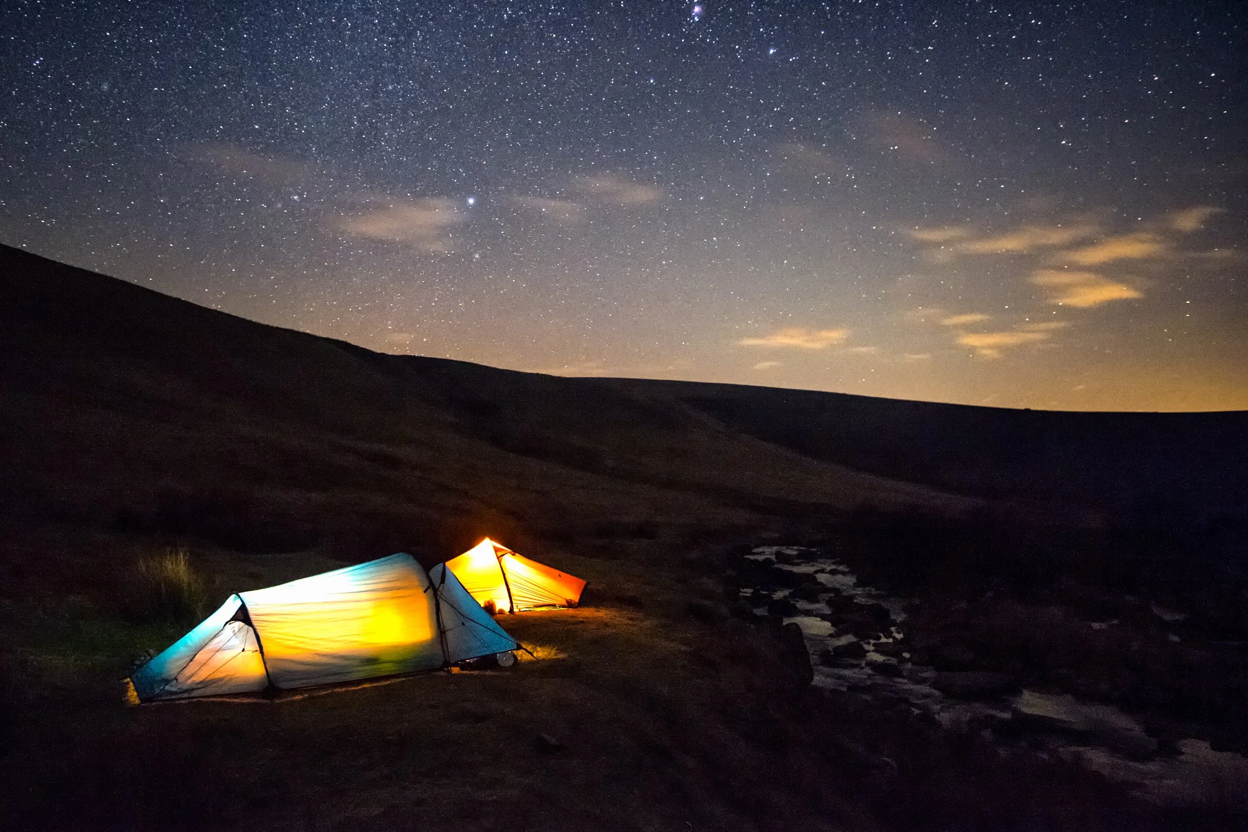
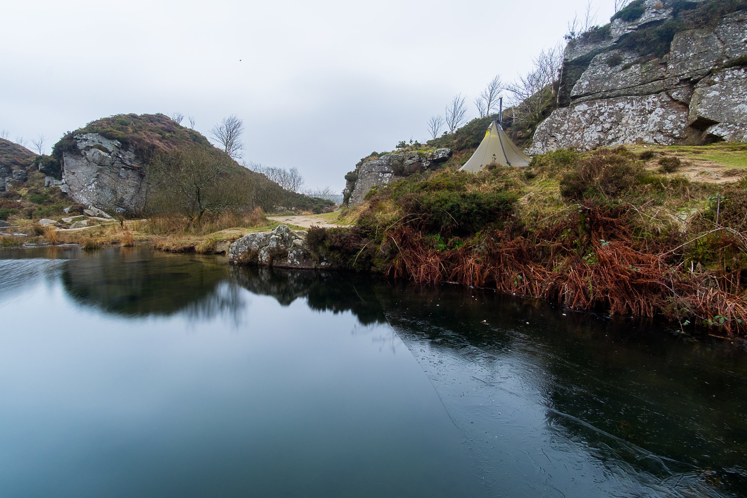
We were starting to get frustrated now; struggling to find some ground that wasn’t frozen and wasn’t filled with granite turned out to be harder than expected, but we’d manage. After some cursing at the quickly growing collection of bent pegs we managed to get the four tents we had pitched, and I settled down for a questionable dinner quickly heated through in the JetBoil before Gerben, Samanta and I enjoyed a round of hot chocolates and headed off to join Ben and Ellie in their tee-pee where their titanium log-stove was burning away.

This idea for a mini-adventure had started just a couple of days before with a quick post to the Dartmor and Exmoor Wild Camping Facebook page:
Hey everyone. I’m heading down this weekend – plan is to wild camp in Haytor Quarry Friday night and then grab some breakfast in the infamous Fox Tor Cafe to come up with a proper plan for a Saturday night camp and walk over breakfast. If anyone wants to join me I’ll probably be parking up about 9ish as I’ve got to travel down from Bristol, but the more the merrier! Anyone else fancy coming along?
The next morning started early — you tend to find that the photographers on trips like this are the last to bed and the first to rise as the light the light is at it’s best at dusk and dawn. Samanta and I were up before sunrise finding our angle to shoot in what turned out to be rather dull and cloudy conditions.
An hour later we’d all gathered in the tee-pee again, enjoying the warmth of the stove in the morning before we packed down and headed back out. Having not eaten anything by 10am we weren’t feeling like the most energetic of people and so all piled back into the cars and headed straight for the newly reopened Fox Tor Café — a personal favourite on Dartmoor.
Sat down next to the fire inside we each ordered a breakfast our our choice, which I quickly followed with two slices of cake (they’re normally sold out of the Lime & Blueberry but it’s amazing). We spent the next few hours chatting anything from backpacking to mountain bikes through to movies and books while we waited for Samanta’s partner — Josh — to navigate the traffic and closed roads to join us for day two.

A little later Ben and Ellie headed home shortly before the rest of us made our way over to Tavy Cleave. We started heading up with Samanta and Josh following the main path while Gerben and I decided to head straight up the river, creating a more interesting path on which to give ourselves a little bit of a challenge. Even so, as we approached the camping site we weren’t far behind Samanta and Josh.

As night set in Samanta and I spent a short amount of time shooting before we all grabbed some food before Josh and Samanta turned in for the night. Gerben and I sat up late into the night discussing various adventure plans before heading off on a short night navigation exercise, getting back shortly before the rain was forecast to start.
Sat in the entrance of our tents we were waiting for the rain to start, signalling the time to turn in for the night. Much to our surprise the complete opposite occurred — the clouds cleared and the skies opened up to reveal a bright starlit sky. At this point I sprang into action grabbing the camera and tripod I’d packed away less than an hour before and pulling them back out to shoot some of the scenes I enjoy shooting the most.
The next hour was spent rushing around with the camera trying to capture as many images as possible. A clear night sky has to be my favourite conditions to shoot in so I wanted to take advantage of this rare occasion of being somewhere with little light pollution and such clear skies.
As I woke the next morning the rain was pattering away on the roof of the tent. I love the sound of falling rain against the thin outer layer of nylon on a tent, but it’s precisely what you don’t want when you’ll soon packing away. My normal habit these days is to leave the JetBoil ready to go for the morning, so pulling on my down jacket I unzipped the tent door and with a twist and a click it roared into life.
Most of my adventures involve some kind of a slog. Big, heavy, packs and long distances to more remote areas of the moor — or even halfway across Europe. Weekends like this one are few and far between, but sometimes they make a nice change from the pain of pushing yourself to the limit.

Eurovelo: Arriving in Thessaloniki
I felt ruined as we were greeted by the warm mediterranean breeze at Thessaloniki Internal Airport. I’d had less than three hours “sleep” the previous night at Glasgow Airport while armed security guards walked around us and bright spot-lights shone down from above. Trying to sleep at an airport is not an enjoyable experience, but it would be worth it for the upcoming six weeks of adventure.
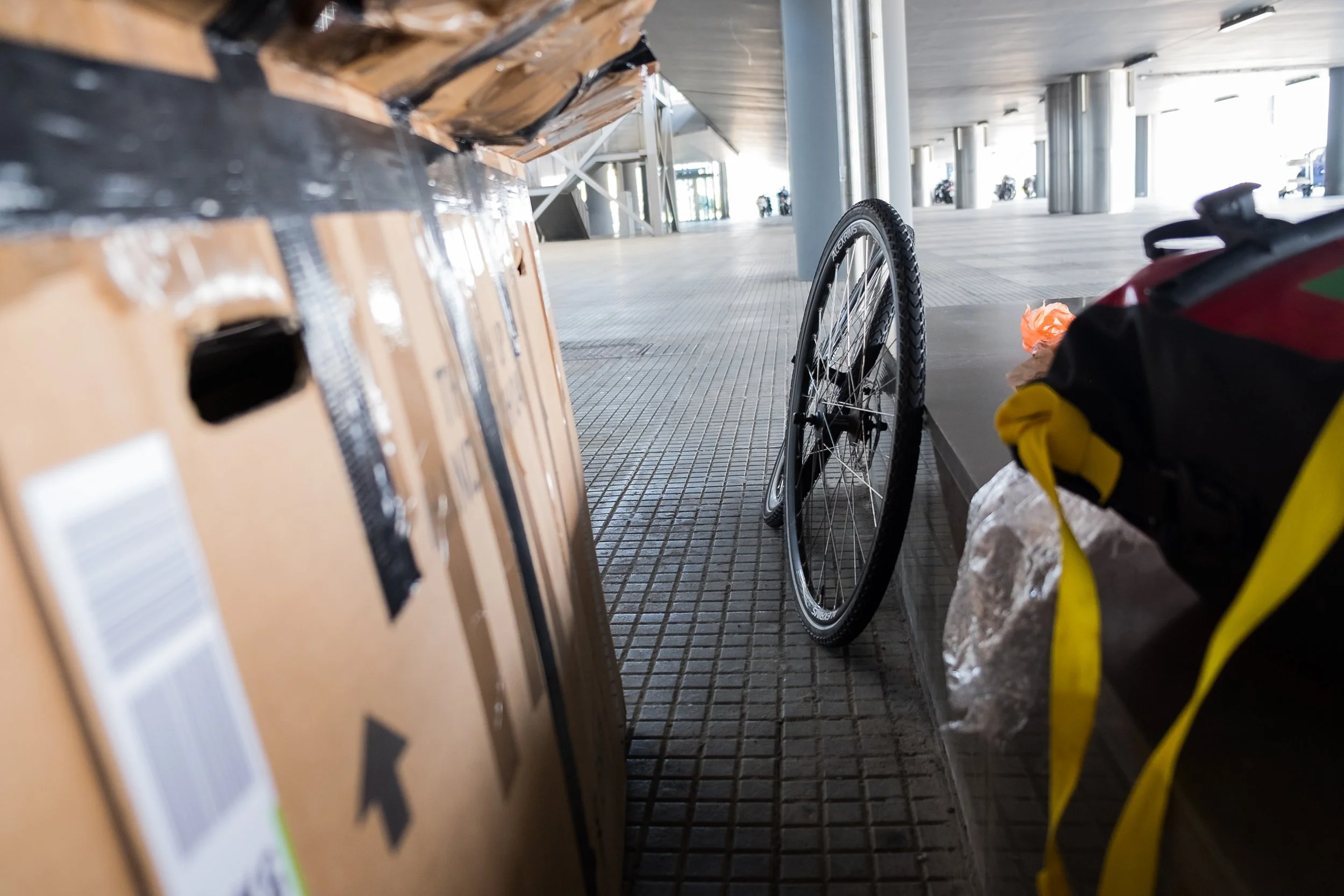
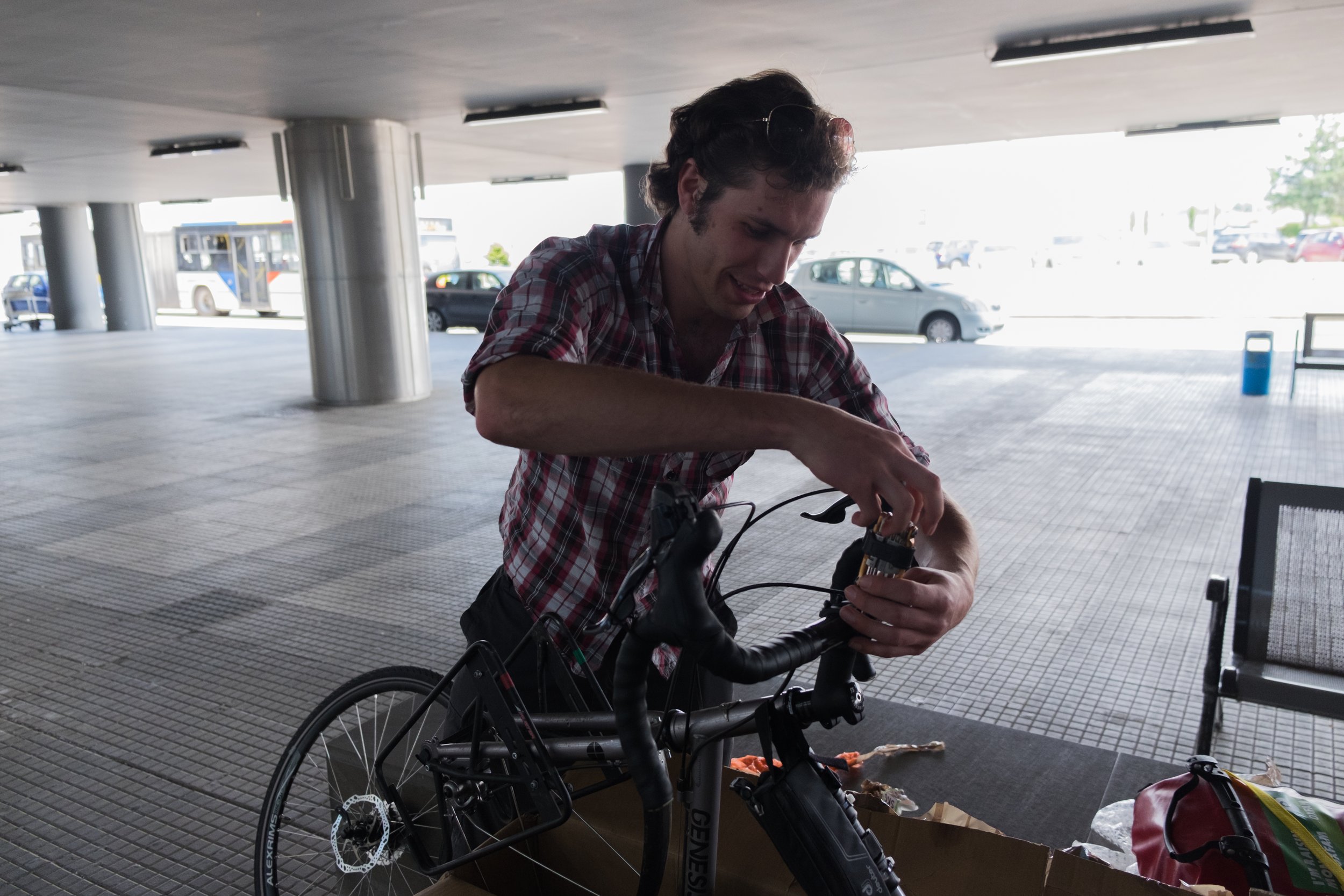
We were both apprehensive as we waited at security for our passports to be checked. We grabbed the least-broken looking trolley to put our abnormally big load on – two large bike boxes and two bundles of duct-taped together panniers – before taking it outside to inspect. The boxes had clearly been handled roughly, but it was the state of their contents that counted.
After the logistical nightmare of finding doors big enough for our trolley to fit through we found a sheltered area and started hacking away at the tape on the bundle with my panniers in. If we could just reach my Leatherman opening the other packages would be so much easier; over the next two hours everything slowly took shape as we began to build the bikes back up, preying that there wouldn’t be any damage to either of them. Both of them went together with nothing worse than having to re-bend a few fenders back into shape.
Pedalling away now we had six weeks on the road ahead of us for our Eurovelo charity expedition. This wasn’t the first tour for Max or I, we completed the infamous John O’ Groats to Lands End cycle a few years ago, but this was different: it was further, foreign, and I was on an entirely new setup. It was unknown. Still though, we had our route already plotted out on the GPS – or so we thought – until we discovered the GPS has been reset during the journey1.
Shakily, and after a few wrong-turns, we found our way to the hotel where we’d be spending our first night in Thessaloniki city – the adventure was underway. Over the next six weeks we would find ourselves traversing mountain passes, cruising long valley floors and sweltering in searing heat as we passed through sixteen countries on our expedition: Greece, Macedonia, Kosovo, Albania, Montenegro, Croatia, Bosnia, Slovenia, Italy, Austria, Germany, Liechtenstein, Switzerland, France, Luxembourg, and Belgium. The 4000km (2500mile) route was all in aid of Mountain Rescue England and Wales, Oxfam Syria Refugee Appeal, and the Shekinah Mission.
Despite all our preparation – our time spent researching and plotting routes – we had to make deviations. Some parts weren’t safe due to the local weather conditions at the time, some were for road blocks, and some were simply to find food, water or accommodation. Despite this, the deviations to our route were relatively minor.
We had the support of a few organisations, without which this trip would have been much more difficult: Solar Technology International, Plymouth University, and Lyon Distribution all supported us and helped us reach the end of the journey by assisting in the financial burdens or by providing us with high-quality gear we’d require to reach the end of the trip.
Writing this now it’s safe to say we’re both glad to stop, if only briefly, and recover a little; 4000km on a bike with a 40kg load takes it’s toll on you. Still though, I’m already itching to get out on the next adventure, to start taking photos again just days after stopping and to get back into the mountains.
Route
As mentioned, we made some minor alterations to the route on the go; the map below shows our final route while you can see the planned route in the Eurovelo Introduction. Our final distance was just over 4000km (2500 miles).

Eurovelo
A few years ago Max and I completed the infamous John O’ Groats to Lands End cycling challenge with a twist of our own, taking in much of Scotland that is missed by many people as we weaved through the outer hebridean islands. We didn’t stop there as we took in parts of Cumbria, Yorkshire, the midlands, Somerset, Exmoor and Cornwall that are normally missed out. This added over 400 extra miles to our route.
As some people will already know this summer we’re stepping up again, this time with even bigger plans. As I write this we’ve been working toward this trip for nearly ten months, planning our route, researching foreign countries and saving the funds we require to complete the challenge. The endgame is simple: fly to Thessaloniki (Greece) and cycle home again (England).
As it stands we’ll be leaving the UK on Sunday 5th June at a rather horrendous 5PM, before landing at 11PM local time in Greece. We will then begin the process of cycling over 4500km home. That’s well over double our John O’ Groats to Lands End challenge.
This trip is being organised with the intention of raising funds for Mountain Rescue England and Wales, Oxfam Syria Refugee Appeal, and the Shekinah Mission. Once we return from this trip we’re hoping to have a catalogue of images and a story to tell in order to help raise further funds for these charities.
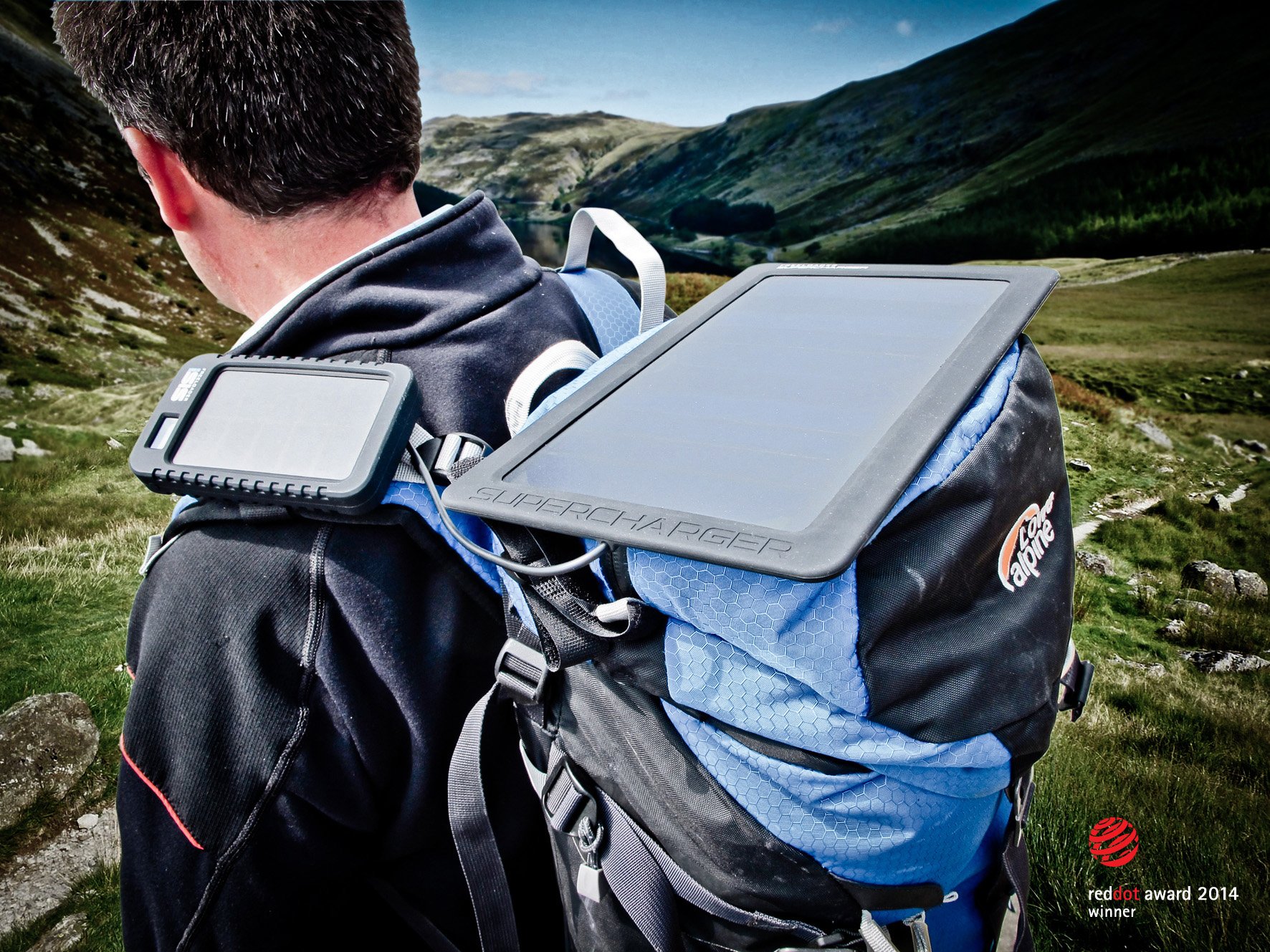
We’d like to thank the University of Plymouth for supporting us with transport, accommodation and food costs for this trip. We’d also like to thank Solar Technology International for providing solar charging for our battery banks which will be critical to keeping our GPS running, phones charged and my camera running.
Route Details
An approximate route has been plotted, which is mapped below. Route statistics:
Distance: 4686km
Climbing: 37,690m
Timeframe: 6 weeks
Updates and Support
You can donate to the trip on Just Giving. I’ll be doing my best to post updates as we go depending on where I can find wifi or we get free data for our phones. These updates will be going on Twitter, Instagram and Facebook. Keep checking back here too, I will put something when we get back from the trip, but it might take a while to appear as I will be jetting off again very quickly afterwards for the next trip.
Mountain Rescue England and Wales
The Mountain Rescue provide a vital service for anyone who spends time in the more remote areas of England and Wales. When accidents occur these volunteers give up their own time to support the emergency services in helping those who are lost, taken ill, injured or otherwise stranded in most difficult circumstances. Equipment and training is expensive and they are notoriously underfunded, and receive little to no government support on both individual team and national level. During the Lakes District floods of christmas 2015 the mountain rescue mustered a huge effort to support the local communities and provide swift-water rescue services.
On Christmas Day, the region mustered 70 out of 150 mountain rescue swift water rescue technicians, along with a further 53 support team members and 30 4X4 vehicles, ready to leave families and be deployed in the event of an expected second storm to hit Cumbria
– Richard Warren, Chairman of the Lake District Search and Mountain Rescue Association, New and Star on the Cumbria Floods Response
The Mountain Rescue provided a 500-strong support during this crisis.
There is very little in the way of central funding, therefore fundraising remains an ongoing and very important task for the teams, with annual costs running at between £30,000 and £80,000 per team and rising.
– Richard Warren, Chairman of the Lake District Search and Mountain Rescue Association, New and Star on the Cumbria Floods Response
You can donate to the Mountain Rescue via Just Giving.
Oxfam Syria Refugee Appeal
After we initially envisioned this trip the Syria refugee crisis occurred and it came to us that our route was not dissimilar to that of the refugees. We will have the creature comforts and paperwork for our journey however the refugees will have nothing; we aim to raise awareness and funds as we make this journey and Oxfam has a well-established history of expertise in humanitarian crisis situations.
You can donate to the Oxfam Syria Refugee Appeal via Just Giving.
Shekinah Mission
A local Devon charity who help to support and rehabilitate the homeless in and around Plymouth. Max and Dan both went though university in Plymouth where both still live. Max and Dan encounter the homeless on a regular basis in the city and are both uneasy that support is underfunded for such people, and spare change isn’t enough to support them in the long run. Supporting a charity that understands and helps will be an effective way of making a difference to the people who need it the most.
You can donate to the Shekinah Mission via their website. They currently do not use Just Giving.
Sponsors
We’re lucky to have had the support of a few companies while arranging this expedition which have helped to ease the financial strain as well as helping the required equipment.
Solar Technology International
Solar Technology International design and manufacture simple Solar powered solutions for everyday use, from lighting in off grid locations, through powering pumps and other electricals to recharging gadgets away from the plug point. Whether you are a gardener, farmer, equestrian, camper, hiker or adventurer there is a product for you. What’s more solar is a green, renewable and free energy source.
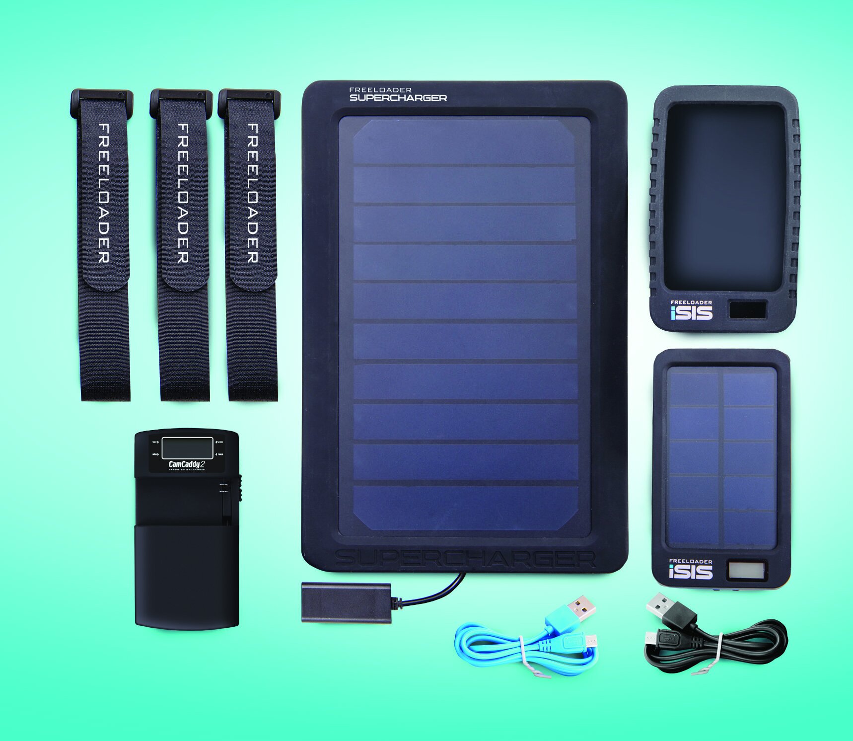
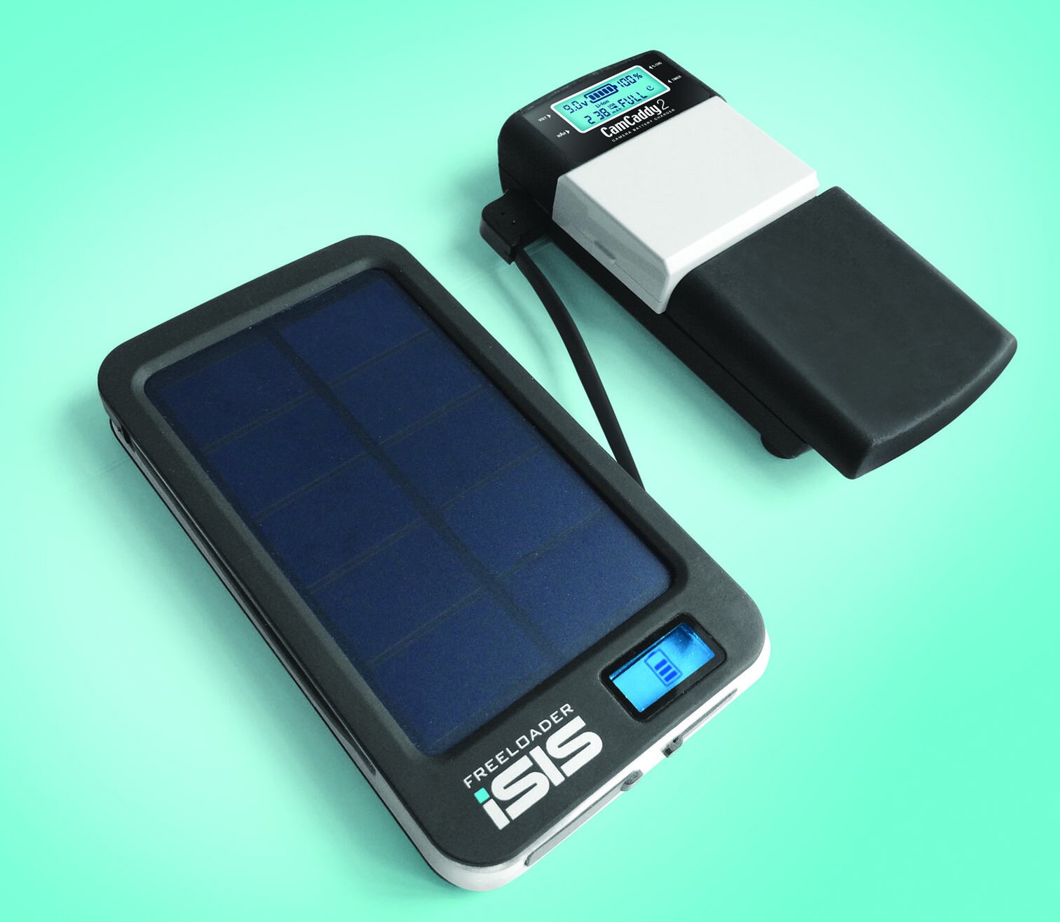
The Globetrotter Clic consists of the ‘Camcaddy 2’ camera battery charger, the ‘FREELOADER iSIS’ solar battery bank and the Supercharger 5-watt Solar booster panel that combine to provide EUROVELO with all the compact and mobile charging power they need for their cameras, GPS devices, iPhones and other gadgets they will need on their challenge.
Solar Technology International is thrilled to be able to support Daniel and Max on their EUROVELO challenge. The FREELOADER iSIS, Camcaddy 2 and Supercharger will enable them to tap into the power of the sun to power this incredible adventure that aims raise money for so many worthy causes.
Adrian Williams, Managing Director of Solar Technology International
Lyon Equipment
Lyon Equipment are the UK distributor for many of the worlds leading outdoor brands including Tubus, Ortlieband Exped. Lyon Equipment were kind enough to provide us with trade prices on equipment they import to help support the expedition.
Plymouth University
Plymouth University have issued Max with the Roland Levinsky grant. This grant is issued each year to help fund student expeditions that are trying to achieve something which benefits society and creates a positive impact on the world. The university awarded our expedition a sum on £1100 to help pay for food, transport and accommodation.
The Roland Levinsky Memorial Fund offers current students who have completed their first year at University the opportunity to enhance their University experience through extra-curricular activities, despite any financial restrictions they may be experiencing.
The Roland Levinsky Memorial Fund was established in 2007 after the tragic death of the then Vice Chancellor, Professor Roland Levinsky, who was dedicated to the principle that individuals should be encouraged to achieve their full potential.
Awards of up to £1,500 enable you to take part in activities which could include anything from participation in a sports club or society, to undertaking a volunteering project overseas.
Press and/or media enquiries
If you’d like more information or to feature the trip, please get in contact. I’m reachable anytime by email: hello@danielgroves.net.
A media pack containing images and a press release is obtainable by contacting myself via email.
Some features have already been published:
Wind, Rain and Mountains
I don’t generally write these posts unless I have a single purpose — to tell the tale of an adventure. This one will be a little different to the others, focusing instead on a week trip to the mountains, specifically the Lake Districtnational park. There was no real purpose for this trip, except to escape to the mountains.
We arrived at Gillside Farm campsite in Glenridding after a nine hour drive up on Thursday 22nd March. It was starting to get dark, but everything seemed calm on the drive in. As we approached the campsite we noticed a group of people walked the other way up the road seemed to be struggling with the wind. Driving across the campsite we quickly noticed one tent was already in a heap, weighted down by some chairs, and others were partially collapsed.

We checked in at reception before returning to the car to get the tents out. Pitching proved difficult, although not as bad as some in the past, thanks to the 50mph winds that were crashing over the campsite. At one point one of the tents attempted to fly away down the campsite, but both went up relatively quickly despite the winds.
Just as I was pegging the guy lines out on my own tent someone approached and asked if we’d seen their tent going past at all. They returned 10 minutes later with it bundled in their arms, throwing it into their car before driving off.

The next morning the weather hadn’t improved. Rain had now been added into the mix, so we retreated to Fellbites Cafe in the village for breakfast before deciding we’d heading to Ambleside for the day to pickup any new gear that was needed, including replacing my old Berghaus Extreme GoreTex jacket that has been slowly disintegrating for the last 6 months or so.
We finished the day with a rather miserable curry cooking under a tarp while it was beating down on us thanks in the wind. At this point the camera was still well buried at the back of the car boot, thanks to the relentless rain.
Thankfully, the weather did eventually improve from torrential downpours to scattered showers which allowed me to put the camera together and start shooting. This improvement set a course for the rest of the week as the weather steadily improved everyday providing more and more shooting opportunities until the final day where I barely put the camera down all day.

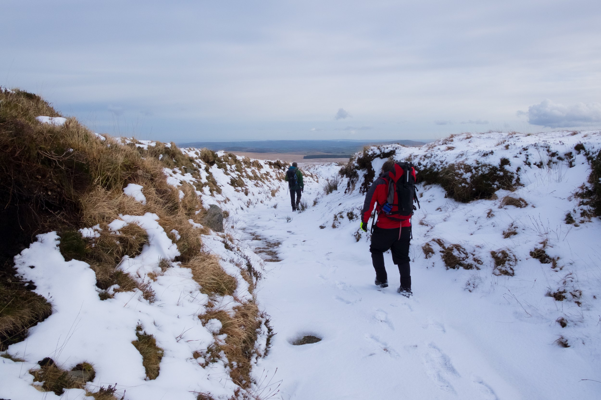
During this final day in the lakes we decided to follow Glenridding Beck out of the campsite to see how much snow coverage was present. Having no winter gear I was not in a position to attempt to climb it this time, although I have completed it on numerous occasions in the past. Plenty of people were making attempts though as we were regularly overtaken by others with ice axes and crampons strapped to their bags.

Despite staying well below the snow line there’s still loads of photo opportunities along the path approaching Red Tarn from the old copper mine hostels. Many of these are on the path itself, while others are jsut a short distance off the beaten track.

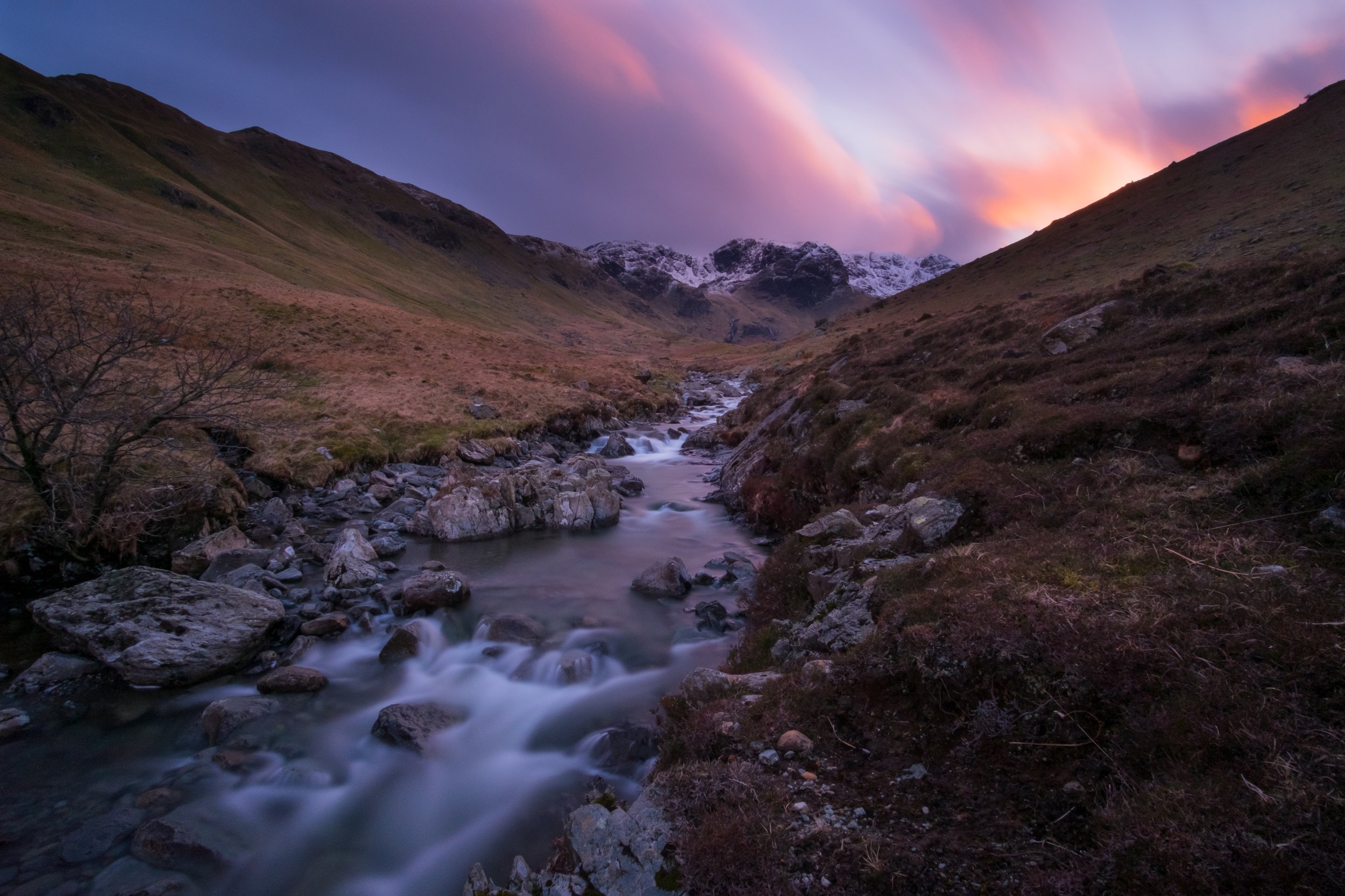
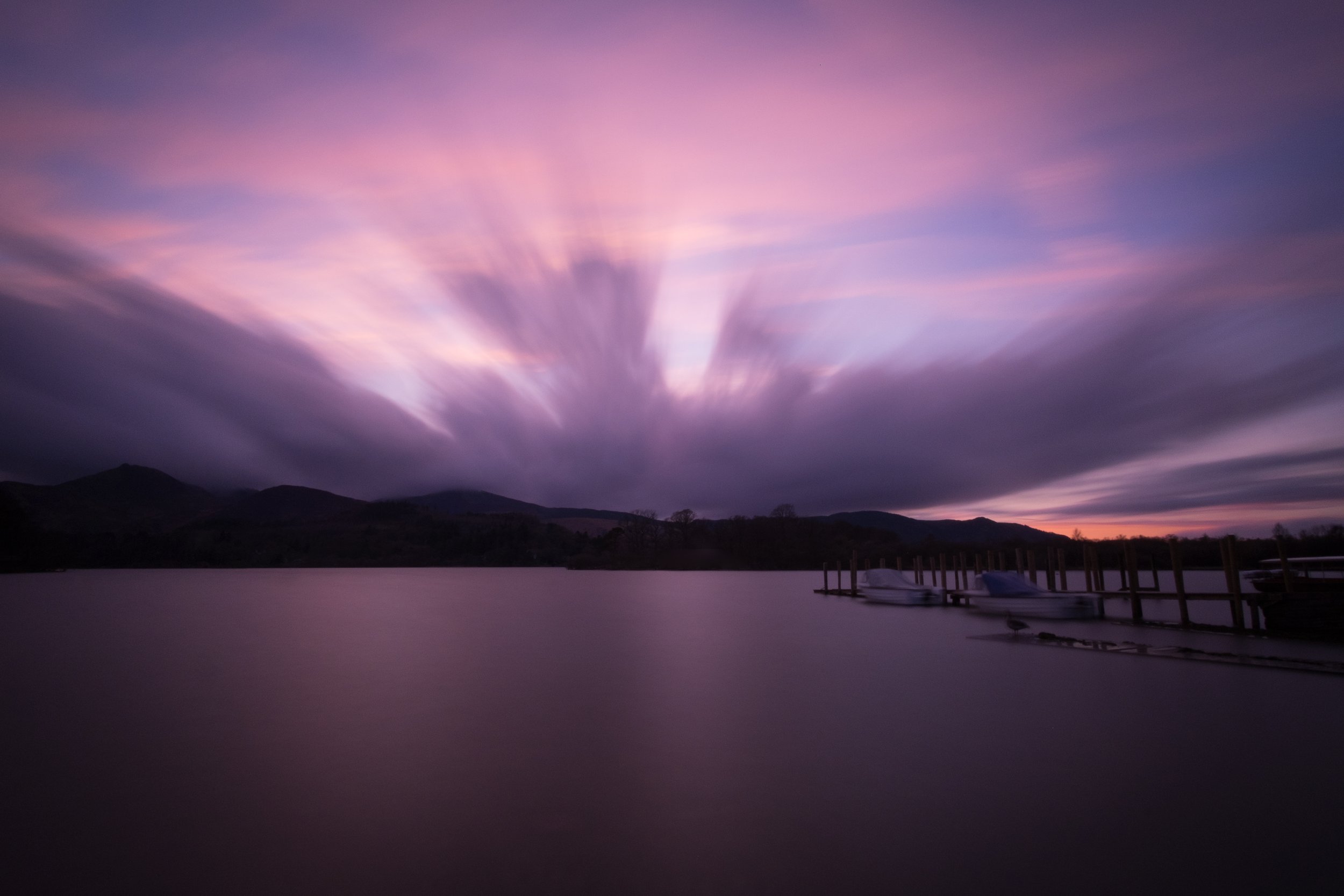
We finished the afternoon back in Fellbites Cafe for a cream tea before heading back out to photograph the sunset from Deepdale Valley where I’d noticed the peaks were in a dramatic setting with heavy snow cover from the road earlier in the week.

We turned up about 90 minutes before the sunset and so had plenty of time to find a good angle and setup. The light took a long time to develop, so I focused on the mountains back down the valley in the east. Eventually the colour started to develop in the west, but only lasted for about ten minutes during which I only managed to get one exposure. Thankfully this was well judged despite the long shutter time capturing all of the movement in the clouds as well as the colour.
This is only a small subset of the images captured during the trip. Keep an eye on my Facebook, Twitter and Instagram accounts for more over the coming weeks.
If you’re interested in the gear I use for shoots like this, checkout my recent post Gear for a Landscape and Adventure Photographer.

Dartmoor and Exmoor Gathering
Most of the trips I write about here are the ones that go well; never focusing on the other end of spectrum where things go wrong, the whether turns for the worst, and where you’re made to suffer to reach your objectives. This latest trip wasn’t as extreme as some, I’ve done far worse, but it still makes for a stark contrast to the others I’ve written about here.
It was 9:00 as I stepped off the 46 bus in Lydford Gorge. As my boot made contact with the road a familiar pitter-patter of rain falling through leaves started, as if to welcome me on my latest adventure. It would have been nice to have a dry start, but I knew this would happen sooner or later with the forecast. I quickly donned my waterproofs, starting with my GoreTex jacket and trousers, before adding my gaiters over the top. For what is quite possibly the first time ever, I even remembered to pull the waterproof cover over my rucksack.
With the forecast being as bad as it was today, I might have saved this trip for another day if it wasn’t for the plan to meet up with a group from the Dartmoor and Exmoor Wild Camping group on High Willhays for the night.
I quickly headed up the road, having a nose around the 12th century castle before moving on. There wasn’t much to see; just the four walls of a tower which their started life as a prison before being converted to a castle in the mid-13th century. Moving on, I made good time to the car park situated behind the Dartmoor Inn, by which time the rain that had started out by greeting me had blown over, allowing me at least have the comfort of walking without waterproof trousers for a while.
I took a quick bearing to make sure I took the right track out of the carpark, and proceeded down the small lane to the footbridge over the River Lyd, stopping briefly to top-up my water having drunk most of it on the bus.
My next target, Widgery Cross situated on top of Brat Tor, was easy to spot as it stood above me. The ground moving up to it was steep, and soon led me above the level of the surrounding hills and into the full-force of the wind — the nearest obstacle being significantly further west on Bodmin Moor. I stopped for a few minutes to take some photos before packing everything back down and getting ready to move on to my next objective.

Just as I was about to shoulder my bag I looked up to the sound of rotor blades. A few seconds later a Sikorsky S-92 search and rescue helicopter appeared above my next objective, Great Links Tor. It circled the tor a few times before proceeding to hover for several minutes, and eventually — slowly — land just out of sight from where I was. I headed off walking towards at Great Links, wondering as I walked if it was a real rescue or a training exercise1. As I moved up the side of Great Links, following a small and unmarked footpath, I noticed the sound of the rotor blades intensify once again, looking up as the helicopter now flew straight over the top of me heading towards Plymouth.
I continued upwards walking around the impressive tops of Great Links Tor before taking shelter at the far end, out of the wind. Here I took another look at the map, having decided to skip heading to Green Tor as I had originally intended; from what I could see it didn’t look like it would have much to offer photographically.
I headed for the disused railway line which used to run between Bridestowe railway station and the Rattlebrook Peatworks2. This railway line was used to transport the peat bricks from the peatworks, using horse-drawn carts, only upgrading to a converted petrol truck in its last days. Dartmoor is littered with such features, and the access tracks generally provide easy and fast access to the grounds of the old industrial works. The ruins offered some form of shelter, and with a fast-flowing stream nearby where I could get some water, I decided to use this spot for a lunch stop.
Things get a little harder after the old peatworks as the ground become saturated once again. The area is clearly well trafficked through with a mixture of old wooden planks and stepping stones at the worst areas which makes crossing the majority of the bogs relatively trivial, even with a full backpacking load. I can only imagine this area is where they used to cut the peat from, and the stones were used to allow the workers to move around while the planks are clearly newer additions.
On arrival at Kitty Tor I took shelter behind the military huts which occupy every tor with a firing-range danger flag. This made for a break from the winds which had begun to take on a bitter chill, lowering the temperature. Right on queue the snow started to fall, just as I was setting up the camera. This only lasted for a few seconds, but gave a promising sign that we would get good coverage from the incoming storm during the night.

Getting to move on once again I spent a few minutes tightening my boots for the descent into the valley where I would cross the West Okement River at Sandy Ford. Taking a bearing of the ford to make sure I arrived at the river in the right place I picked a path and proceeded down the hill, taking care not to slip and risk injuring myself on the steep ground. As I neared the bottom I diverted around a particularly bouldery area, noticing that there was much easier ground to travel on off to one side.
As I approached the ford I quickly realised there was going to be a problem here — the river was flowing too high and too fast — I wasn’t going to be able to cross here. I decided to head upstream, I’d spotted a waterfall on the other side I wanted to have a look at while descending into the valley and hoped there might be somewhere nearby where I could cross; the river only got deeper. I continued further upstream hoping the river would narrow, or there would be some rocks I could use as stepping stones.
There was nothing; I pulled out the map, hopeful to find something useful.
I had two options. I could head south and hope the ground was dry enough to cross at the source of the river, and risk being forced back if it was too wet and too boggy. Alternatively, I could go north and cross using the footbridge over weir at Vellake Corner. This second option required covering over twice the distance to cross the river, but was a guarantee of crossing. From where I was I could clearly see that High Willhays was shrouded in fog, and so arriving in daylight was important if I was to find the group. I headed north, now using both walking poles to help keep the pace up.
I stuck close to the edge of the river where the ground was firmest. Before long I was passing the Black-a-Tor Copse nature reserve, and it was just past here where I spotted a group of five or six backpackers on the far bank. I suspected it at the time, and they later confirmed, it was once of the other parties heading up to High Willhays on the route I would later take.
It took around an hour to reach the footbridge at the weir, turning up in less style than I’d hoped as I slipped on the steep grass hillside while making my way down. I’d been forced higher up by the steep gradient near Shelstone Tor which was causing a pain through my ankle due to walking across a 45-degree angle for long periods of time. Thankfully no damage was done as my large rucksack took the worst of the fall, so I proceeded over the bridge before taking advantage of this final water source of the day to clean the mud from my hands and take on my maximum volume of water ready for making food and drinks at the camping spot.
Heading up the track back towards the nature reserve I was now carrying a full two kilograms more than I had started with at the beginning of the day, a volume I noticed very quickly. A couple of minutes later a lady stopped me and asked what I was doing. I told her I was walking from Lydford Gorge to High Willhays, only to be asked what I was training for. I told her this wasn’t training, and I did it for fun, leaving her with a look of disbelief on her face as she walked off.
I kept my pace fast, estimating another 90-minutes of guaranteed light with the fog higher up, and set myself a target of reaching High Willhays within an hour. It didn’t take long for the track to run out, where I had to head off piste. I picked a sensible looking line up to Black Tor which got the climbing out of the way quickly, before turning to my final destination which, although somewhere above me and less than 1400 meters away, could not be seen. I took a bearing for the top of the tor and proceeded to walk on it.
Sixty minutes after leaving the weir I arrived on top of High Willhays.
I was surrounded by fog, on top of a large tor, and I had no idea where exactly the others would be camping, and quickly realised, especially in the high winds, I was only going to find them by trail and error. I pulled out the map again and started thinking about where I’d camp in these conditions; it would have to be on the East side to get some shelter from the wind, probably behind one of the three clumps of rock that make-up the summit. There’s a group camping, so the biggest would be a sensible place to start — a clearing in the fog moved over. I turned and there was a tent with two people stood next to it; I grabbed my bag, stuffing the map back in, and made for it.

A I stopped now I quickly realised how tired I was; I’d only eaten a packet of fig rolls and a Pot Noodle all day. Mike quickly showed me where the main group of tents were, and I pitched in the middle of the group with, Mike’s help to stop the tent from blowing away. The wind was clearly going to be an issue in the night, so I attached some backup guy lines to the additional four tabs to reinforce the existing ones.
With the tent up I pulled my cooker out and proceeded to cook some food just inside the porch and sort my equipment out, piling on extra layers to help keep the cold wind at bay. It’s often surprising what difference a hot meal can make to how you feel.
I went to say hello to the others.
At first I thought I was dreaming; someone was faintly calling my name in the distance. I rolled over, but there it was again.
I woke up.
I spent a couple of minutes wrestling with unseen pull-cords and zips until I could sit up in my sleeping bag, just as a well-timed gust hit the tent-side on, bending the pole double and hitting the side of my head. Not quite the wake-up I had imagined when I went to sleep the night before. I heard my name get called again, and had a quick conversation with Mike shouting, through the material and over the wind. It was time to pack-up and head out, with a low-pressure incoming, and bringing more bad whether with it.

The wind was pounding the side of my tent, making everything that little bit harder as the material frequently tried to push me down as the pole bent under the strain of the wind; it’s much better suited to being pitched with one end pointing into the wind, but sometimes this isn’t possible. Jamming all of my gear back into the various dry sacks now littering the inside of my tent I quickly packed everything away — breakfast would have to wait. I went to open the tent door, but the second I released the storm clip on the door it was pulled out of my hand, the wind opening the zip for me. I threw my rucksack and poles out, before following them out into the wind and fog, where most people were wrestling their tents into the stuff sacks.
Working around the tent logically I unpegged all of the down-wind guy lines, and began unpegging the base to release the tension on the pole so I could remove it. As I pulled the second peg out the wind cut directly under the now weightless tent, lifting everything a pulling all but two of the remaining pegs as the tent shot upwards trying to pull itself away, while throwing most of the remaining pegs straight into my face. Thankfully Raven was nearby and watching, who joined me in jumping on the tent to restrain it from taking off.
With the tent safely strapped to my rucksack, I proceeded to help a few of the others fight similar battles their newly converted tent kites.
Once everyone was packed down, we moved off as a group into the heavy fog. These conditions do not allow for easy navigation, but led by Robin with careful use of the gradient and bearings to navigate off we soon made it down with only a few people falling into the classic Dartmoor holes en-route. It’s trips like this one which really make you appreciate how lucky we are to have modern gear such as lightweight GoreTex waterproofs.

Dawn to Dusk
Saturday started at 5:30 to the sound of my alarm clock shouting at me. It was time to get moving, as I was meeting James in thirty minutes to head up onto Dartmoor and shoot the sunrise. We headed up to Sharpitor where we could access the tor in just a couple of minutes from the car park and the bottom, as well as take advantage of its stunning backdrop. The minus two degrees celsius on the car thermostat didn’t mean much as the wind soon added its own chill factor on top.
We weren’t expecting much from the sunrise, but as a low cloud bank moved over we were soon surprised as the colours quickly developed. Once the sun was up we had to move quickly to meet Mike in 40-minutes time.
We arrived at Postbridge at 8:50, and were walking by 9:00. The first location we had in mind was a waterfall on the east dart river – to be exact, the waterfall I visited during Solo over the summer months. The setting was drastically different the last time I had been there and offers a huge range of angles thanks to the unique rock formations and the non-uniform setting of the waterfall. We stopped there for a good 20 minutes, but could happily have spent a few hours shooting a huge range of different angles.

We proceeded north after this towards Winney’s Down. This is a large and not overly steep area of land which had built up some fairly deep snow drifts in places. This made it hard-going as our feet had to sink through several inches of snow, followed by grass. We also had to be aware that there could be thin ice below the snow covering uninviting bog water.
Continuing north we soon reached Quintin’s Man Cairn, tucked just inside the firing range. This marked the start of being able to follow paths again which made the going easier until we reached Whitehorse Hill and proceeded to follow the peat pass. This was easily the best conditions I’ve ever faced the pass in, which normally channels water effectively making it hard and messy work.
We now turned our attention to the east, Watern Tor in particular. We’d earmarked this for stopping for a bit of lunch, and hoped to shoot the top if any light presented itself. This made for hard work as we cut across Walla Brook Head which had some of the deepest snow we’d faced on some steep and slippery ground as we descended onto the plateau. Once we’d raised out of the other side we picked up a fairly well trodden path north until we reached the tor. Between several ten-tors training groups sitting on the tor for lunch, and only very brief spells of good light none of us shot anything here, and we proceeded to move on once again.

Out next stop was Teignhead Farm, where James and I bikepacked to back in spring. Here we took advantage of the shelter to crack the cookers out and make another brew while we killed a little time before we needed to move on to get on location for shooting the sunset.
We headed south again as a group but split soon after as James and I made for the top of Sittaford Tor, and Mike made for the Grey Wethers stone circle. We all had out own successes at our locations as the three of us came back with completely unique images.
We quickly regrouped at the stone circle as the light proceeded to go, and moved south again quickly to cover the worst of the wet ground with some natural light. We were soon defending down to the river under the beams of our head torches looking foreword to a well earned meal and an evening going through the results of the days shooting.


Nightwalk
We’d gone out looking for snow, but hadn’t expected it quite so soon. It was 23:00 on Friday 20th November, Mike and I had just parked in the Two Bridges car park and started walking along the path to Wistmans Wood.
We were both well buried in GoreTex to keep the biting wind at bay bringing with it a wind chill of minus six degrees celsius. As we proceeded past the gate our head torches punched into the pitched black emptiness ahead, quickly illuminating the small snow flakes drifting down to meet us.
This small flurry quickly increased in size and pace as the winds picked up. We were now being pelted by the snow; with our hoods pulled down and everything zipped up tightly we kept moving forward, trying to see the path ahead.
The brief snow storm finished as quickly as it had started, and we were soon making good ground once again. We made our way along the main path towards Wistmans Wood until we spotted the turn-off which would lead us up to Longaford Tor. Once up here we searched around for the driest and most sheltered spot we could find, cutting the worst of the wind out in exchange for an area slightly steeper than ideal. After breaking the ice from our rucksack fastenings we pulled our tents out and got everything setup as quickly as the winds would allow us.
Pulling my sleeping equipment out of my rucksack was when I discovered the first of several gear failures that would occur on this trip. One side of my sleeping mat was soaked, which quickly led to the discovery of my water bladder leaking inside my bag. My vital gear is all stored inside dry bags, which kept the critical items safe.
The warmth from a down jacket is immediate; something I was thankful for as I walked back up the side of Longaford Tor to photograph the lit-up tents below. Stood here you could feel the wind creeping through all and any gaps, desperate to find it’s way inside the numerous layers tasked with keeping each of us warm. Wearing thinner gloves to maintain enough dexterity to operate a camera quickly left my finger tips numb, something remedied by returning to the tents for a brew. It was now 01:00 on Saturday morning, and time to get some sleep before getting up in six hours time to shoot the sunrise.

The next morning I slept through all three alarms. In the end it was pure luck that I woke up just as the sunrise began, resulting in a need to move fast in order to get setup. Walking up the last few metres to the top of Longaford Tor quickly exposed us to the biting wind. Ignoring this we split to find our own angles to shoot in order to make the most of the low morning light.
The soft pink-orange colours didn’t last long as the sun quickly rose above the low and fast-moving clouds. I moved quickly through a series of locations, first making use of the colours in the clouds, before moving on to take advantage of Mikes silhouette on the Tor above, and then the low but now direct sunlight on the moorland around. It was while changing filters during this next shoot that I discovered the second gear failure of the trip: the mount for my lens hood had broken off the lens, making the hood now completely useless as it now obstructed the view.

Back in the tents we could start to relax a little more now we were out of the wind. I could feel my finger tips softly tingling as the blood-flow returned after removing my gloves to handle the filters required for the long exposures I had been doing just a few minutes earlier. The ease of starting the pre-heat cycle on my MSR stove quickly proved once again how well designed the unit is, and sped the way to return my fingers to their normal state. You cannot beat the feeling of of a hot drink and breakfast to warm you through after shooting in cold conditions.

Once we were both fed and watered it was time to move on. We’d planned a return route via Beardown Tors which meant taking a brief walk down the to West Dart River before finding a way across. We’d intended to use the weir to to do this, but seeing enough water flowing over this to flood our boots, something neither of us were keen on, we proceeded to move further up the river to look for somewhere else to cross.
I was moving in front of Mike, weaving through grass and hoping between rocks and holes, when I heard a call behind me. Turning around I could just see Mikes head and shoulders as he’d managed to fall straight into a hole I’d just hoped over. After helping pull Mike out we agreed it was unlikely we’d find anything by continuing further up river, and so returned to take another look at the weir.

On this second look we noticed a series of rocks below the weir led up to the central wall. Here we could traverse past the wider half of the weir, walk up the central wall, and then jump over the narrower but deeper and faster second half. Thankfully this plan worked out well, which would otherwise have been disastrous had one of us fallen in. With this we’d now unlocked our access to the Beardown Tors.

The walk up to the top of Beardown was quick, despite our loads. As we came up to the crest the winds hit us once again, so we immediately sought out some shelter where we got a brew on and had a quick bite to eat in our small pocket of shelter within the chaos surrounding us.
We spent a short while here enjoying the time in the sun and out of the wind before making our way down to the leat, which we followed into a small woodland, stopping to photograph the contrasting light and colours surrounding a leat overflow duct. It was here that Mike managed to snap a leg off his tripod while setting up; the third and final gear failure of the trip.
Leaving this woodland the snow was starting to fall once again. This motivated us to move along the last part of the leat quickly, before turning off onto a farm track which took us further along to the river. Here we took the path down the south-facing bank and followed this all the way back into Two Bridges.
